


Cette page vous donne les différences entre la révision choisie et la version actuelle de la page.
|
en:doc_mont_st_michel [2011/05/27 08:18] mega |
en:doc_mont_st_michel [2015/02/18 11:05] (version actuelle) |
||
|---|---|---|---|
| Ligne 1: | Ligne 1: | ||
| ====== Saint Michael's Mount ====== | ====== Saint Michael's Mount ====== | ||
| + | |||
| + | <WRAP download>{{:fr:mont_st_michel.pak.zip|}}</WRAP> | ||
| ===== A little bit history ===== | ===== A little bit history ===== | ||
| - | Mont Saint-Michel (pronounced: [mɔ̃ sɛ̃ mi.ʃɛl]; English: Saint Michael's Mount) is a rocky tidal island and a commune in Normandy, France. It is located approximately one kilometre (just over half a mile) off the country's north coast, at the mouth of the Couesnon River near Avranches. | + | Saint Michael's Mount (in french Mont Saint-Michel) is a rocky tidal island and a commune in Normandy, France. It is located approximately one kilometre (just over half a mile) off the country's north coast, at the mouth of the Couesnon River near Avranches. |
| {{:fr:mont_saint_michel_wikipedia_mini.jpg|}} | {{:fr:mont_saint_michel_wikipedia_mini.jpg|}} | ||
| Ligne 11: | Ligne 13: | ||
| The population of the island is 41, as of 2006. The island has been a strategic point holding fortifications since ancient times, and since the 8th century AD it became the seat of the Saint-Michel monastery, from which it draws the name. | The population of the island is 41, as of 2006. The island has been a strategic point holding fortifications since ancient times, and since the 8th century AD it became the seat of the Saint-Michel monastery, from which it draws the name. | ||
| - | Mont Saint-Michel was previously connected to the mainland via a thin natural land bridge, which before modernization was covered at high tide and revealed at low tide. This connection has been compromised by several developments. Over the centuries, the coastal flats have been polderised to create pasture. Thus the distance between the shore and the south coast of Mont-Saint-Michel has decreased. The Couesnon River has been canalised, reducing the flow of water and thereby encouraging a silting-up of the bay. In 1879, the land bridge was fortified into a true causeway. This prevented the tide from scouring the silt around the mount. | + | |
| [[http://en.wikipedia.org/wiki/Mont_Saint-Michel|Wikipedia source]] | [[http://en.wikipedia.org/wiki/Mont_Saint-Michel|Wikipedia source]] | ||
| Ligne 19: | Ligne 21: | ||
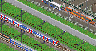
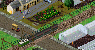
| Few views of project under construction | Few views of project under construction | ||
| - | {{:fr:vue_mont_st_michel_3.png|}} | + | {{:fr:mt_st_michel_vue_jour.png|Summer view}} |
| + | {{:fr:vue_hiver_jour.png|Winter view}} | ||
| + | {{:fr:vue_hiver_nuit.png|Winter view by night}} | ||
| + | |||
| + | |||
| + | ===== Caracteristics ===== | ||
| + | |||
| + | |||
| + | * Sort of building = curiosity | ||
| + | * Size = 5 x 5 tiles | ||
| + | * height = 3 tiles | ||
| + | * passengers' ratio=200 | ||
| + | * Introduction year=1900 | ||
| + | * ratio of construction (chance)=65 | ||
| - | View in game (scale 1) | ||